3D laser scanning
Accurate scans of lines, structures, and sites, delivered as point clouds you can measure and check for clashes.
The Process:
How is 3D scan data captured and registered?
In the field of engineering, a 3D laser scanner is a sophisticated device that captures three-dimensional data of real-world objects. This technology can be used in a variety of applications such as architecture, manufacturing, and construction. The scanner works by using lasers to measure and map the surface of an object into a software program. This creates a digital replication of the object that can then be studied, modified, or replicated using various computer-aided design tools. With its precision and accuracy, a 3D laser scanner is an invaluable tool for professionals looking to create detailed models or analyze and improve existing designs. Its wide range of applications demonstrates the versatility and usefulness of this technology to various industries.
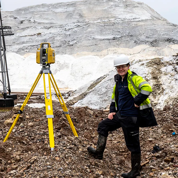
To set up and utilize a 3D laser scanner outdoors, it is essential to follow specific guidelines to achieve accurate and satisfactory results. Firstly, choose a location that is suitable for outdoor scanning and minimize any potential obstructions or movement. Secondly, establish a safe setup to avoid any harm to individuals or equipment. Next, ensure that the laser scanner is appropriately calibrated for outdoor usage and select the appropriate scan settings. During scanning, continuously monitor the acquisition process to detect and resolve any issues. Finally, post-process data to produce 3D models. It is important to keep in mind that outdoor scanning requires more preparation as compared to indoor scanning and always double-check all aspects. Through following these professional guidelines, you can effectively setup and use a 3D laser scanner outdoors.
The Benefits:
Why hire Us to Scan your Asset?
3D laser scanning technology offers several benefits in various industries, including architecture, construction, engineering, and manufacturing. This technology can accurately capture objects, buildings, and environments with high precision and detail, creating highly accurate 3D models and point clouds that can be leveraged in different applications. Some benefits of 3D laser scanning include faster and more accurate data collection, increased job site safety, reduced project costs, improved communication and collaboration among project stakeholders, and better project outcomes. By using 3D laser scanning technology, project teams can save time, reduce errors, and optimize project workflows, leading to improved project efficiency and quality. Moreover, this technology provides enhanced visualization and analysis capabilities that can help stakeholders make better-informed decisions throughout the project lifecycle.
The Limitations:
When is laser scanning less effective?
As a professional, it is important to consider the limitations of 3D laser scanning when using this technology for various applications. One of the main limitations is the inability of this method to detect materials that are not reflective or transparent. Additionally, when scanning objects with complex geometries or intricate details, the scanner may not capture the entire surface accurately, resulting in incomplete or inaccurate data. Another important consideration is the time and cost associated with the scanning process, which can be extensive when scanning large, complex objects or structures. It is crucial to also keep in mind that 3D laser scanning is not a standalone technology and requires additional software and resources for data processing and analysis. Therefore, a comprehensive understanding of the limitations and capabilities of this technology is key to effectively utilizing it for your project.
Deliverables
Point cloud deliverables
Registered point cloud data, accurately referenced to OSGB. Available in a variety of formats including LAS, RCP, and E57.
Clash Detection
Point cloud data can be used to detect clashes between different objects or structures. This is useful for avoiding potential problems during the construction process.
Online Point Cloud Viewer
Visit our Point Cloud viewing site to see how you can fully utilise point cloud data in your business
Visit pointclouds.uk (opens in a new tab)