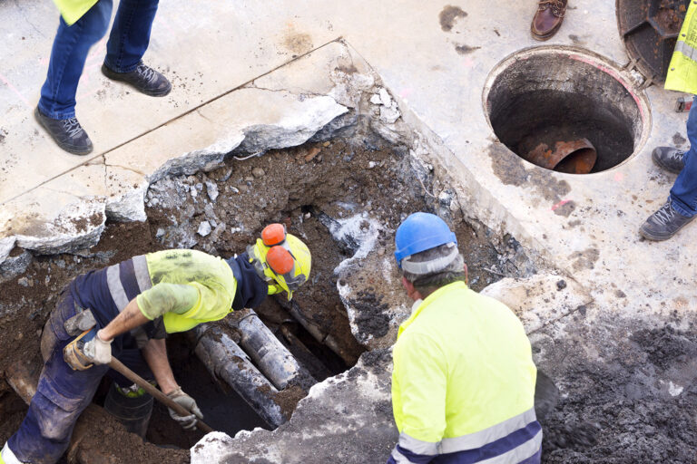
Underground utility tracing is the process of identifying the location of buried utility lines and marking their position on the ground. Utility lines usually run underground, carrying electric power, data, gas, water, and sewage, among other things. Tracing these underground lines is important because accidentally hitting or disrupting them during excavation or construction work can result in costly repairs, injuries, and even fatalities. Underground utility tracing involves using technologies such as ground penetrating radar, electromagnetic detectors, and GPS mapping to locate utility lines. This information is then used to create a map that shows where the utility lines are located so that anyone who intends to carry out digging or excavation work can avoid damaging them. It is also essential for maintaining the safety of the general public, as well as construction personnel.
Tracing underground utilities with a cat and genny involves two pieces of equipment: a cable avoidance tool (CAT) and a signal generator (Genny). The CAT is used to detect the presence of buried cables or pipes. The Genny then sends a signal along the cable or pipe that is detected by the CAT. This signal can be used to trace the path of the underground utility. The process typically involves first scanning the area with the CAT to identify any potential underground utilities. Once a signal is detected, the Genny is used to send a specific signal along the cable or pipe. This can be done through connective clips or direct connection to the utility. The CAT can then track the location of the utility and any changes in direction or depth. Using a CAT and Genny to trace underground utilities is an effective and efficient way to locate potential risks before excavation work begins, reducing the risk of damage to utilities and ensuring works are carried out safely.
Tracing buried utilities is a crucial step in any construction or excavation project. There are several benefits to tracing buried utilities, including reducing the risk of costly and dangerous accidents caused by inadvertently damaging underground lines. By identifying and mapping the location of utility lines prior to excavation, construction and engineering crews can prevent damaging water, gas, electrical, or fiber optic lines, leading to minimized downtime and increased safety. Additionally, tracing buried utilities can promote efficient planning, reducing unnecessary work, increases productivity and minimize disruption to traffic and surrounding communities. This information is often essential in the application for permits, providing a clear picture of the work required and minimizing the likelihood of having to apply for additional permits. Overall, the benefits of tracing buried utilities are many and ultimately contribute to the successful and smooth completion of any project while ensuring the safety of workers, surrounding communities, and the integrity of infrastructure.
Tracing buried utilities is a challenging task that involves detecting and mapping underground pipes, cables, and other infrastructure. However, this process has its limitations that should always be taken into account. Firstly, the accuracy and reliability of the equipment used can be affected by several factors, such as soil conditions, depth, and type of utility. Secondly, some utilities may not be detectable, especially if they are too deep or made of non-conductive materials. Thirdly, accidents may occur during excavation, causing damage to the utilities and posing a risk to workers. Lastly, some utilities may have been abandoned or removed without updating records, leading to incorrect mapping and detection. Therefore, it is crucial to consult with utility owners, follow safety regulations, and use reliable equipment and techniques to ensure the safety and efficiency of excavation.
For tracing underground utilities we have standardized on C.Scope CAT's and Gennys as well as Dart Systems Reels and Cameras for pipe tracing and inspection.
All our underground location services can be enhanced by our topographic surveying capability to ensure you know exactly where that buried service is.

We trace underground utilities using advanced technology to analyze gas, water, and telecom lines. Our experienced team prioritizes safety and minimizes property disruption, identifying and addressing potential hazards. Contact us for reliable service and customer satisfaction.


One of our team will be in touch soon