When conducting commercial drone flights, it is important to obtain proper permissions from the Civil Aviation Authority (CAA), with a few exceptions. Our team begins by defining the flight area and obtaining necessary clearance for the flight. Upon receiving take-off clearance, we proceed with executing the flight and gathering the required data. This information is then utilized to produce various deliverables such as orthomosaics and point cloud models. Our team ensures that all operations are carried out in compliance with regulations and safety standards to ensure the best possible outcomes for our clients.
Modern site mapping involves a complex set of tasks and responsibilities that require advanced equipment and technology. One of the most essential tools for this process is the survey drone, which offers numerous benefits that are simply invaluable. Survey drones are equipped with advanced capabilities that allow them to provide accurate and reliable data, while enhancing the safety of workers on-site. One of the main advantages of survey drones is their ability to cover large areas efficiently, significantly reducing the amount of time and resources required for this task. Additionally, survey drones can gather highly detailed data that can be processed to create highly accurate 2D or 3D maps, which can be used for a variety of purposes. The real-time data gathering capabilities of survey drones also enable quick decision-making and improved communication among team members, thus boosting overall productivity. Perhaps one of the most significant benefits of using survey drones is the reduction in risk for workers on-site. Drones can access dangerous or hard-to-reach areas without exposing human workers to potential risks and hazards, thus reducing the risk of injury and other safety concerns. Overall, investing in survey drones is a smart and effective way to improve the efficiency and safety of any site mapping project, while delivering high-quality results that meet or exceed project requirements.
One of the challenges associated with the utilization of Unmanned Aerial Vehicles (UAVs), otherwise known as drones, to map areas is their limitations. These limitations include factors such as their limited battery life, maximum flight time, flying altitude, and range. Also, drones' ability to capture detailed images or data is affected by weather conditions, such as wind, rain, or fog. This limitation often results in incomplete or inaccurate mapping data for areas with challenging terrains. In addition, the process of drone mapping requires a trained pilot, qualified to handle and maneuver the device, and the software to process the acquired data. Nonetheless, despite the limitations, drones have become an essential technology in mapping, providing valuable insights used in various industries such as agriculture, real estate, and urban planning, among others.
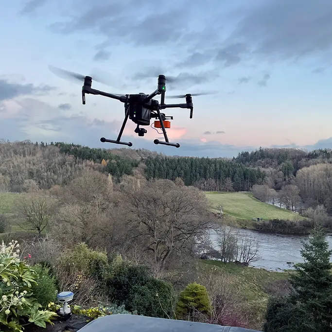
Our current fleet of drones includes a DJI M210, a Mavic Pro, and a custom-built heavy-lift Vulcan X8.
The M210 is our primary mapping drone equipped with the DJI X4S camera. We also have the XT Thermal camera and a Z30 zoom camera for aerial inspections.
Line Design Technology Limited are proud to offer drone mapping and survey services that we compete promptly while still delivering highly accurate results and remaining cost-effective.
We can do this thanks to unmanned aerial vehicles, more commonly referred to as drones.
This type of aerial survey enables LDT to reach areas that are difficult to access without the exorbitant costs and higher altitudes of helicopter surveying.
In addition to being licensed in the operation of remote-controlled aircraft, LDT also has the necessary permissions from the Civil Aviation Authority to carry out authorised aerial surveys.
When it comes to aerial data, it is all about the deliverable.
There’s no point in having the latest shiny drone tech that captures high-resolution data if you have no way to deliver that data to your client efficiently and effectively.
As a company, we have invested in the latest photogrammetry software and equipment to collect our data, which is excellent for our in-house staff with the experience and fast computers to work with large point clouds and high-resolution imagery.
The problem is that when clients want to use that data on their project, they also need to invest a considerable amount of time and resources to benefit.
We spent a long time looking for a simple way to enable our clients to leverage point cloud data without needing expensive workstations and hours of training.
Our solution uses Potree, an open-source framework that allows a user to view and interact with point cloud data using a web browser. Potree eliminates the need for expensive software and IT support. We host your data in the cloud on our secure server. You gain the benefits of interacting with our data without the hassle of coding or installing any 3rd party software.
We host the data using Amazon Web Services, enabling us to utilise the power and reliability of the Amazon network while ensuring our infrastructure costs are kept low, thus saving you money.
The ability to view rich 3D data at the push of a button allows your project management to understand the complexities of a site better while maintaining security and avoiding costly mistakes.
Below is our sample dataset; if you want to experience the full power of our point cloud viewer, visit our dedicated site pointclouds.uk

One of our team will be in touch soon