Topographic surveys are usually conducted using specialized equipment that can measure the elevation of the land surface. This data is then used to create a contour map, which shows the shape of the land in two or three dimensions. This type of map can be used to identify potential problems with drainage or flooding and to locate areas of high or low ground that might be suitable for different types of development.
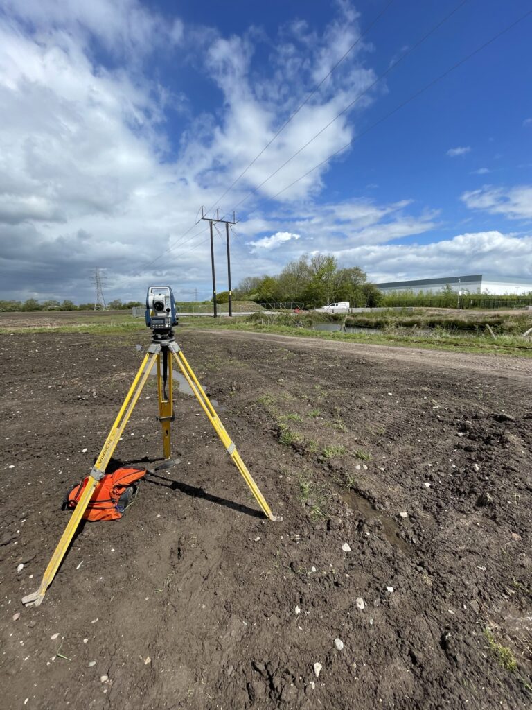
Conducting a topographic survey requires a great deal of accuracy and skill. The first step is to establish control points. These are points on the ground that have been precisely located and marked. They will be used as reference points for all other measurements during the survey.
Next, measurements are taken from the control points to other points on the ground using a measuring device such as a total station or laser scanner. These measurements are then plotted on a map. The contours of the land are then drawn based on these measurements. Finally, any features on the ground (trees, buildings, etc.) are added to the map.
Topographic surveys are an essential tool for planners, engineers, and architects as they provide critical information about the lay of the land. This information can be used to create more accurate plans and drawings for proposed developments to ensure the Architects vision is possible, and all aspects of the development are appropriately planned.
There are many reasons why a topographic survey may be helpful. For example, if you are planning to build a structure on your land, then you need to know the elevation of the land to ensure that the foundation is built correctly. Additionally, a topographic survey can be used to plan for infrastructure projects such as powerlines, pipelines, and roads.
Knowing the specific features of your development is a critical first step in ensuring the smooth progress of any construction activities. There’s nothing worse than having your expensive personnel waiting around while the Architect sorts out a problem that could have been avoided by having accurate information in the first place.
There are many reasons why accuracy is vital in a topographic survey. For example, if you are planning to build a road on a piece of land, it is crucial to know the exact elevation of the land to ensure that the road will be built at the correct grade. A topographic survey can also be used to determine property boundaries, which can be necessary for legal purposes.
While a topographic survey can provide valuable information, some limitations exist.
One limitation is that a topographic survey only provides data for a specific point in time. This means that any changes to the landscape after the survey is conducted will not be reflected on the map. Another limitation is that a topographic survey can only provide accurate data for the actual surveyed area. If a critical feature falls outside the survey boundaries, it will not be included on the map.
Finding competent persons to conduct such a survey can also be challenging. We often find lots of people have the latest shiny survey kit that promises a specific accuracy, but in reality, they haven’t paid attention to the fundamental principles of surveying accurately.
Despite these limitations, a topographic survey can still be a helpful tool for planning and development purposes.
Our Company Surveyors are equipped with Sokkia Total stations and Carlson BRx7 GNSS receivers. We also have available the latest 3D laser scanners from Topcon.
As our equipment enables us to work on Ordnance Survey OSGB datum, we thus ensure compatibility with your existing and 3rd party data.
Topographic surveying involves analyzing and documenting the natural features and landmarks on a landmass. This includes inspecting buildings, trees, and streams to define the land’s boundaries and elevation. It’s crucial for land development, urban planning, and environmental conservation.

One of our team will be in touch soon